GEORGETOWN, DELAWARE (10/1/2015) As the East Coast awaits the northerly movement of Hurricane Joaquin, Sussex County officials said this afternoon they are concerned a nor’easter developing now may combine with the later storm to bring up to 7 inches of rain, wind gusts up to 50 mph and major beach erosion.
Severe coastal flooding could strand residents in low-lying areas into next week, though no evacuations have been ordered, according to a statement from the Sussex County Emergency Operations Center.
Joseph L. Thomas, director of the center, said, “There is a lot to be concerned about with the forecast, so the public needs to be prepared now and move, if possible, before flood waters come in.”
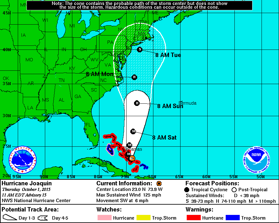
The latest projection for Hurricane Joaquin as it moves up the East Coast has shifted it slightly to the east but still including Delaware in the likely area of a downgraded tropical storm late Monday or early Tuesday, experts at the National Hurricane Center say.
But they caution that the range of possible outcomes is still large, including a landfall in the Carolinas.
By 2 p.m. today, Joaquin’s eye was 70 miles south-southeast of San Salvador in the Bahamas, with maximum sustained winds increased to 130 mph.
The wind-speed increase makes Joaquin a Category 4 hurricane on the Saffir-Simpson scale.
The hurricane center earlier predicted a 1 percent chance of sustained 64 mph winds for Dover, and a 25 percent chance for 34 mph winds. There is a 5 percent chance for 64 mph winds at Ocean City, Maryland.
Moderate to major coastal flooding likely in Delaware